14
15
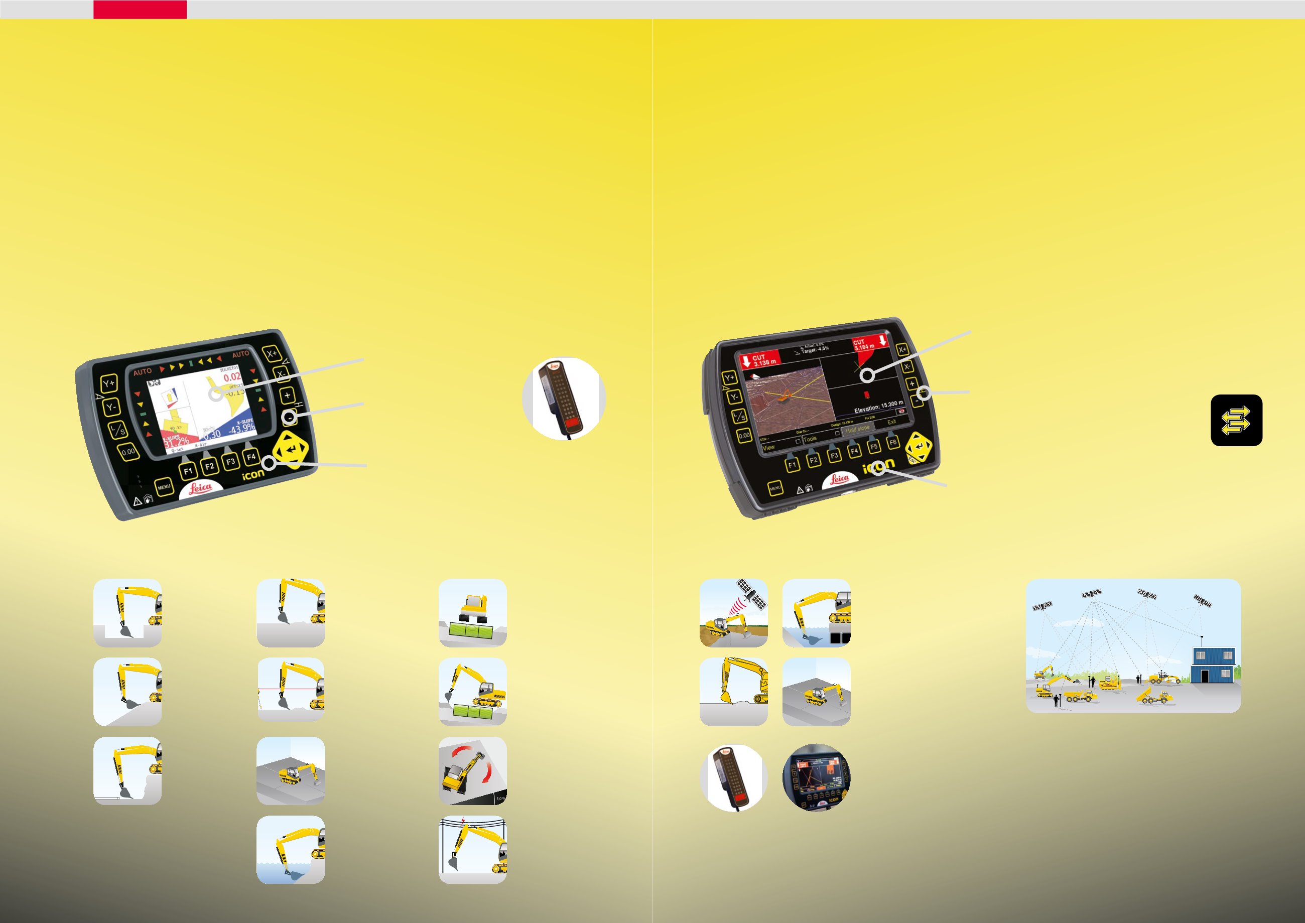
Our dual-slope system combines the depth,
pitch and roll – giving you a complete picture
of the excavation works.
iXE2 is suitable for small road excavation jobs,
drainage work or parking lot excavations.
An additional rotation sensor on the
counterweight upgrades the system to a
dual-slope capability. The 2D function uses a
compass to fix the slope direction. This means
that you can move the machine without the
system losing the direction.
The dual-slope system contains two sensors
that record the pitch and roll and compensate
for the tilt of the machine.
The machine can thus stand at an inclined
position and still carry out levelling work
around the entire machine.
2D excavating system functions
DEPTH
Commonly used
for bases,
foundations, etc.
SLOPE
Set the desired
slope for the
embankment.
PIPELAYING
Set the desired
depth and slope
of the pipe
trenches.
UNDERWATER
WORK
The bucket motion
is shown in the
graphical display.
GRADING WORK
Set the right depth
and the desired tilt
in one direction.
LASER REFERENCE
Gives possibility to
use rotating laser as
a reference.
HEIGHT ALERT
An audible signal
warns the operator if the
defined limit is exceeded.
useful around bridges and
overhead lines.
GRADIENT
The system can
handle both pitch
and roll.
Easy-to-use graphical
display
Short learning curve thanks to
smart menus
The Snap-on, Snap-off
capacity makes it easy to
remove the machine control
box from the cab
ROLL
Sensors record and
compensate for the
machine tilt.
PITCH
Sensors record and
compensate for the
machine tilt.
COMPASS
The system uses a
compass to establish
the direction of the tilt.
Arrow display
indicating the
bucket height
iCON excavate
iXE2, 2D excavating system
The iCON telematics
services include fast
and easy data transfer
from office to site and
to construction machines,
remote support for the operators
and basic fleet management
functionality.
The wireless cradle makes it
easy to place and remove the
computer unit from the cab
With the 3D system from Leica Geosystems, you will
work with high precision GPS and be able to monitor
the excavation position by means of a digital model.
The iXE3 enables you to use the excavator for point
collection and stake out activities.
iXE3 is suitable for projects requiring staking out,
e.g. large road and infrastructure projects and
subdivisions, industrial sites or dereliction works.
Connect the machine computer via the built-in GSM
modem to get quick support and transfers files.
Our 3D system enables you to take the last step
towards machine control. Your efficiency rate will
improve by up to 30% making it easy to gain return
on the investment.
GPS/3D functions
3D/GPS
Our 3D system enables
you to use dual slope in
2D and reference models
in 3D.
ICON 3D software
Complete your system with
iCON 3D, the software
that allows you to create
terrain models directly
on the screen. A function
that gives you great onsite
freedom.
2D or 3D
Switch between the
2D and 3D screens
by just pushing a
button!
The machine computer
receives the machine
position through a GPS
signal and the bucket
position from the
excavation system.
These values are then
matched with the digital
surface. You will see the
bucket move over the
design surface telling you
how deep to go.
GPS/3D on your machine
Clear screen display that
can be easily read in
strong sunlight
LED illuminated buttons
Remote site and
machine access
iCON excavate
iXE3, 3D excavating system


